


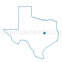
Voting District 0403, Falls County, Texas
About
Outline

Summary
| Unique Area Identifier | 673001 |
| Name | Voting District 0403 |
| County | Falls County |
| State | Texas |
| Area (square miles) | 134.99 |
| Land Area (square miles) | 133.39 |
| Water Area (square miles) | 1.61 |
| % of Land Area | 98.81 |
| % of Water Area | 1.19 |
| Latitude of the Internal Point | 31.30054880 |
| Longtitude of the Internal Point | -97.12052470 |
Maps


Graphs
Select a template below for downloading or customizing gragh for Voting District 0403, Falls County, Texas


Neighbors
Neighoring Voting District (by Name) Neighboring Voting District on the Map
- Voting District 0073, McLennan County, TX
- Voting District 0074, McLennan County, TX
- Voting District 0075, McLennan County, TX
- Voting District 0076, McLennan County, TX
- Voting District 0104, Falls County, TX
- Voting District 0105, Falls County, TX
- Voting District 0301, Bell County, TX
- Voting District 0301, Falls County, TX
- Voting District 0302, Falls County, TX
- Voting District 0404, Falls County, TX
Top 10 Neighboring County Subdivision (by Population) Neighboring County Subdivision on the Map
- Waco CCD, McLennan County, TX (179,824)
- Moody-Lorena CCD, McLennan County, TX (12,584)
- Marlin CCD, Falls County, TX (8,477)
- East Bell CCD, Bell County, TX (6,219)
- Mart CCD, McLennan County, TX (5,788)
- Chilton CCD, Falls County, TX (2,937)
- Lott CCD, Falls County, TX (2,244)
- Perry CCD, Falls County, TX (755)
Top 10 Neighboring Place (by Population) Neighboring Place on the Map
Top 10 Neighboring Unified School District (by Population) Neighboring Unified School District on the Map
- Robinson Independent School District, TX (10,496)
- Marlin Independent School District, TX (9,304)
- Lorena Independent School District, TX (7,277)
- Troy Independent School District, TX (5,977)
- Rosebud-Lott Independent School District, TX (4,928)
- Bruceville-Eddy Independent School District, TX (4,059)
- Riesel Independent School District, TX (2,265)
- Chilton Independent School District, TX (2,140)
Top 10 Neighboring State Legislative District Lower Chamber (by Population) Neighboring State Legislative District Lower Chamber on the Map
- State House District 55, TX (176,215)
- State House District 56, TX (155,303)
- State House District 57, TX (144,556)
Top 10 Neighboring State Legislative District Upper Chamber (by Population) Neighboring State Legislative District Upper Chamber on the Map
Top 10 Neighboring 111th Congressional District (by Population) Neighboring 111th Congressional District on the Map
Top 10 Neighboring Census Tract (by Population) Neighboring Census Tract on the Map
- Census Tract 38.01, McLennan County, TX (6,582)
- Census Tract 201, Bell County, TX (6,219)
- Census Tract 38.02, McLennan County, TX (6,002)
- Census Tract 8, Falls County, TX (3,992)
- Census Tract 37.01, McLennan County, TX (3,159)
- Census Tract 2, Falls County, TX (2,937)
- Census Tract 36.02, McLennan County, TX (2,614)
- Census Tract 5, Falls County, TX (2,244)
Top 10 Neighboring 5-Digit ZIP Code Tabulation Area (by Population) Neighboring 5-Digit ZIP Code Tabulation Area on the Map
- 76706, TX (35,015)
- 76661, TX (8,708)
- 76655, TX (7,831)
- 76557, TX (5,178)
- 76579, TX (4,258)
- 76524, TX (2,867)
- 76682, TX (2,660)
- 76656, TX (2,276)
- 76630, TX (1,840)
- 76632, TX (1,778)